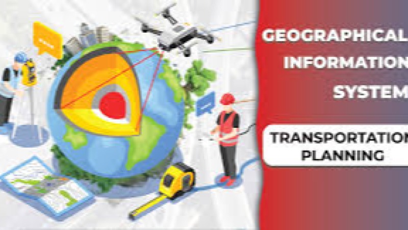
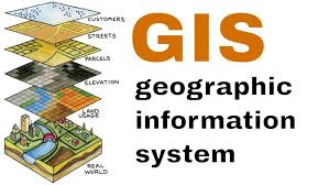
Gis Courses
Explore instructor-led and hybrid programs aligned to practical Gis use cases across industries.
Available Gis Courses
Showing 1-40 of 40 courses
5 days
Accra, Addis Ababa, Bangkok, Cape Town, Dubai, Istanbul, Kigali, Nairobi, Singapore
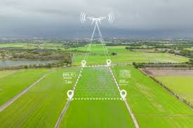
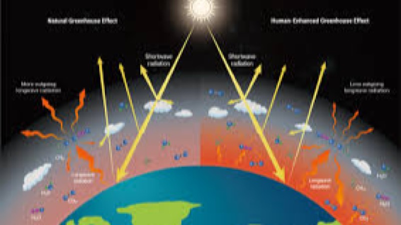
Advanced GIS for Climate Change Research Training Course
Advanced GIS for Climate Change Research Training Course empowers professionals and researchers with comprehensive knowledge and practical expertise in utilizing Geographic Information Systems (GIS) to assess, analyze, and predict climate change patterns.
Advanced GIS for Climate Change Research Training Course empowers professionals and researchers with comprehensive knowledge and practical expertise in utilizing Geographic Information Systems (GIS) to assess, analyze, and predict climate change patterns.
Information Technology
10 days
Accra, Addis Ababa, Bangkok, Cape Town, Dubai, Istanbul, Kigali, Nairobi, Singapore
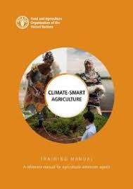
Climate-Smart Agriculture Training course
Climate-Smart Agriculture Training course equips participants with the knowledge and practical skills to navigate these challenges and build resilient agricultural systems
Climate-Smart Agriculture Training course equips participants with the knowledge and practical skills to navigate these challenges and build resilient agricultural systems
10 days
Accra, Addis Ababa, Bangkok, Cape Town, Dubai, Istanbul, Kigali, Nairobi, Singapore
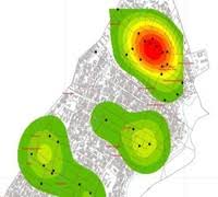
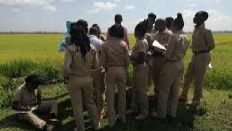
Crime Mapping and Geospatial Analysis (GIS for Criminology) Training Course
Training Course on Crime Mapping & Geospatial Analysis (GIS for Criminology) is a cutting-edge program designed to empower professionals in the criminal justice and public safety sectors with advanced skills in spatial data analysis.
Training Course on Crime Mapping & Geospatial Analysis (GIS for Criminology) is a cutting-edge program designed to empower professionals in the criminal justice and public safety sectors with advanced skills in spatial data analysis.
10 days
Accra, Addis Ababa, Bangkok, Cape Town, Dubai, Istanbul, Kigali, Nairobi, Singapore
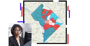
Crime Mapping and GIS for Criminology Training Course
Crime Mapping and GIS for Criminology Training Course equips professionals and students with data-driven decision-making skills, utilizing location-based crime analytics, predictive policing, and spatial pattern detection.
Crime Mapping and GIS for Criminology Training Course equips professionals and students with data-driven decision-making skills, utilizing location-based crime analytics, predictive policing, and spatial pattern detection.

10 days
Accra, Addis Ababa, Bangkok, Cape Town, Dubai, Istanbul, Kigali, Nairobi, Singapore
Crime Mapping and Predictive Policing Algorithms Training Course
Crime Mapping and Predictive Policing Algorithms Training Course is designed to equip law enforcement professionals, criminologists, data analysts, and justice system stakeholders with the advanced skills needed to interpret crime data, identify patterns, and make proactive decisions based on real-time and historical data.
Crime Mapping and Predictive Policing Algorithms Training Course is designed to equip law enforcement professionals, criminologists, data analysts, and justice system stakeholders with the advanced skills needed to interpret crime data, identify patterns, and make proactive decisions based on real-time and historical data.

10 days
Accra, Addis Ababa, Bangkok, Cape Town, Dubai, Istanbul, Kigali, Nairobi, Singapore
Data Analytics for Crime Analysis Training Course
Data Analytics for Crime Analysis Training Course is designed to provide law enforcement professionals, intelligence officers, and data analysts with actionable insights into crime data and analytical techniques that are revolutionizing modern policing.
Data Analytics for Crime Analysis Training Course is designed to provide law enforcement professionals, intelligence officers, and data analysts with actionable insights into crime data and analytical techniques that are revolutionizing modern policing.
5 days
Accra, Addis Ababa, Bangkok, Cape Town, Dubai, Istanbul, Kigali, Nairobi, Singapore
Disaster Management for Wildlife Training Course
Disaster Management for Wildlife Training Course is designed to equip conservationists, wildlife managers, environmental professionals, and policymakers with practical skills and advanced knowledge to handle wildlife emergencies.
Disaster Management for Wildlife Training Course is designed to equip conservationists, wildlife managers, environmental professionals, and policymakers with practical skills and advanced knowledge to handle wildlife emergencies.
5 days
Accra, Addis Ababa, Bangkok, Cape Town, Dubai, Istanbul, Kigali, Nairobi, Singapore
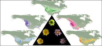
Ecological Niche Modeling and Species Distribution Training Course
Ecological Niche Modeling and Species Distribution Training Course provides a robust framework for understanding and applying ENM/SDM using advanced computational tools, geospatial analysis, and environmental datasets
Ecological Niche Modeling and Species Distribution Training Course provides a robust framework for understanding and applying ENM/SDM using advanced computational tools, geospatial analysis, and environmental datasets

5 days
Accra, Addis Ababa, Bangkok, Cape Town, Dubai, Istanbul, Kigali, Nairobi, Singapore
Ecological Risk Assessment Training Course
Ecological Risk Assessment Training Course provides professionals with the tools to apply advanced risk assessment methodologies, regulatory frameworks, and ecological modeling techniques.
Ecological Risk Assessment Training Course provides professionals with the tools to apply advanced risk assessment methodologies, regulatory frameworks, and ecological modeling techniques.

5 days
Accra, Addis Ababa, Bangkok, Cape Town, Dubai, Istanbul, Kigali, Nairobi, Singapore
Endangered Species Management Training Course
Endangered Species Management Training Course provides an advanced learning experience tailored for conservation professionals, environmental managers, policy advocates, and researchers committed to biodiversity protection.
Endangered Species Management Training Course provides an advanced learning experience tailored for conservation professionals, environmental managers, policy advocates, and researchers committed to biodiversity protection.

5 days
Accra, Addis Ababa, Bangkok, Cape Town, Dubai, Istanbul, Kigali, Nairobi, Singapore
Geographic Information Systems (GIS) for Data Visualization Training Course
Geographic Information Systems (GIS) for Data Visualization Training Course empowers professionals, researchers, and decision-makers to transform raw geographic data into compelling, interactive maps and dashboards that reveal hidden patterns and insights.
Geographic Information Systems (GIS) for Data Visualization Training Course empowers professionals, researchers, and decision-makers to transform raw geographic data into compelling, interactive maps and dashboards that reveal hidden patterns and insights.

10 days
Accra, Addis Ababa, Bangkok, Cape Town, Dubai, Istanbul, Kigali, Nairobi, Singapore
Geographic Information Systems (GIS) for Social Protection Program Mapping Training course
Geographic Information Systems (GIS) for Social Protection Program Mapping Training Course is meticulously designed to equip social protection program managers, M&E specialists, data analysts, ICT professionals, spatial planners, emergency response coordinators, and researchers with the expert knowledge and practical methodologies
Geographic Information Systems (GIS) for Social Protection Program Mapping Training Course is meticulously designed to equip social protection program managers, M&E specialists, data analysts, ICT professionals, spatial planners, emergency response coordinators, and researchers with the expert knowledge and practical methodologies

10 days
Accra, Addis Ababa, Bangkok, Cape Town, Dubai, Istanbul, Kigali, Nairobi, Singapore
Geographical Profiling of Offenders Training Course
Geographical Profiling of Offenders Training Course equips participants with in-depth knowledge of how to analyze spatial behavior patterns of serial offenders, providing law enforcement agencies, criminal profilers, and forensic analysts with valuable insight to predict, locate, and apprehend criminals more efficiently.
Geographical Profiling of Offenders Training Course equips participants with in-depth knowledge of how to analyze spatial behavior patterns of serial offenders, providing law enforcement agencies, criminal profilers, and forensic analysts with valuable insight to predict, locate, and apprehend criminals more efficiently.
10 days
Accra, Addis Ababa, Bangkok, Cape Town, Dubai, Istanbul, Kigali, Nairobi, Singapore
Geospatial Analysis for Climate Change Adaptation Training Course
Geospatial Analysis for Climate Change Adaptation Training Course is a crucial step toward building a more climate-resilient future by empowering individuals and organizations with the geospatial intelligence needed for impactful climate action.
Geospatial Analysis for Climate Change Adaptation Training Course is a crucial step toward building a more climate-resilient future by empowering individuals and organizations with the geospatial intelligence needed for impactful climate action.
5 days
Accra, Addis Ababa, Bangkok, Cape Town, Dubai, Istanbul, Kigali, Nairobi, Singapore
GIS for Road Safety and Traffic Planning Training Course
GIS for Road Safety and Traffic Planning Training Course leverages cutting-edge GIS technologies, spatial analytics, and real-time data modeling to equip professionals with the skills to enhance road safety, manage traffic congestion, and support sustainable urban mobility initiatives.
GIS for Road Safety and Traffic Planning Training Course leverages cutting-edge GIS technologies, spatial analytics, and real-time data modeling to equip professionals with the skills to enhance road safety, manage traffic congestion, and support sustainable urban mobility initiatives.
Skills

5 days
Accra, Addis Ababa, Bangkok, Cape Town, Dubai, Istanbul, Kigali, Nairobi, Singapore
GIS Mapping for Humanitarian Response Training Course
GIS Mapping for Humanitarian Response Training Course is designed to provide participants with practical skills and knowledge on applying GIS technology in disaster preparedness, emergency response, and recovery processes.
GIS Mapping for Humanitarian Response Training Course is designed to provide participants with practical skills and knowledge on applying GIS technology in disaster preparedness, emergency response, and recovery processes.
5 days
Accra, Addis Ababa, Bangkok, Cape Town, Dubai, Istanbul, Kigali, Nairobi, Singapore
GIS Server Administration Training Course
GIS Server Administration Training Course offers in-depth expertise in battery charging protocols, server configurations, power backup systems, and data center integration.
GIS Server Administration Training Course offers in-depth expertise in battery charging protocols, server configurations, power backup systems, and data center integration.

10 days
Accra, Addis Ababa, Bangkok, Cape Town, Dubai, Istanbul, Kigali, Nairobi, Singapore
Infectious Disease Outbreak Investigation and Control Training Course
Infectious Disease Outbreak Investigation and Control Training Course focuses on practical, evidence-based methodologies rooted in epidemiology, public health surveillance, and laboratory diagnostics.
Infectious Disease Outbreak Investigation and Control Training Course focuses on practical, evidence-based methodologies rooted in epidemiology, public health surveillance, and laboratory diagnostics.

5 days
Accra, Addis Ababa, Bangkok, Cape Town, Dubai, Istanbul, Kigali, Nairobi, Singapore
Pastoralism and Wildlife Conservation Training Course
Pastoralism and Wildlife Conservation Training Course equips participants with the knowledge and skills to implement effective conservation strategies while promoting the resilience of pastoral communities.
Pastoralism and Wildlife Conservation Training Course equips participants with the knowledge and skills to implement effective conservation strategies while promoting the resilience of pastoral communities.

10 days
Accra, Addis Ababa, Bangkok, Cape Town, Dubai, Istanbul, Kigali, Nairobi, Singapore
Predictive Policing and Crime Forecasting Training Course
Predictive Policing and Crime Forecasting Training Course integrates real-time data modeling, crime pattern recognition, and proactive resource deployment, supported by real-world case studies and applications from leading law enforcement agencies globally.
Predictive Policing and Crime Forecasting Training Course integrates real-time data modeling, crime pattern recognition, and proactive resource deployment, supported by real-world case studies and applications from leading law enforcement agencies globally.

10 days
Accra, Addis Ababa, Bangkok, Cape Town, Dubai, Istanbul, Kigali, Nairobi, Singapore
Remote Sensing for Conservation Training Course
Remote Sensing for Conservation Training Course is designed to equip conservation professionals with the technical skills to leverage satellite imagery, aerial surveys, and other earth observation data to effectively manage natural resources, protect biodiversity, and implement sustainable conservation strategies
Remote Sensing for Conservation Training Course is designed to equip conservation professionals with the technical skills to leverage satellite imagery, aerial surveys, and other earth observation data to effectively manage natural resources, protect biodiversity, and implement sustainable conservation strategies

10 days
Accra, Addis Ababa, Bangkok, Cape Town, Dubai, Istanbul, Kigali, Nairobi, Singapore
Training course on Neglected Tropical Diseases (NTDs)
Training Course on Neglected Tropical Diseases (NTDs) equips participants with advanced knowledge of disease epidemiology, surveillance systems, rapid diagnostics, community engagement models, mass drug administration (MDA), and vector control interventions.
Training Course on Neglected Tropical Diseases (NTDs) equips participants with advanced knowledge of disease epidemiology, surveillance systems, rapid diagnostics, community engagement models, mass drug administration (MDA), and vector control interventions.

10 days
Accra, Addis Ababa, Bangkok, Cape Town, Dubai, Istanbul, Kigali, Nairobi, Singapore
Training Course on 3D Modeling and Photogrammetry with Drones (Advanced)
Training Course on 3D Modeling and Photogrammetry with Drones (Advanced) is designed for professionals seeking to elevate their skills in capturing, processing, and analyzing spatial data with unmanned aerial vehicles (UAVs).
Training Course on 3D Modeling and Photogrammetry with Drones (Advanced) is designed for professionals seeking to elevate their skills in capturing, processing, and analyzing spatial data with unmanned aerial vehicles (UAVs).

10 days
Accra, Addis Ababa, Bangkok, Cape Town, Dubai, Istanbul, Kigali, Nairobi, Singapore
Training Course on Advance Spatial Autocorrelation Analysis
Training Course on Advance Spatial Autocorrelation Analysis is designed to equip professionals with the expertise to critically analyze spatial dependencies, identify hotspots and coldspots, and build robust geospatial models.
Training Course on Advance Spatial Autocorrelation Analysis is designed to equip professionals with the expertise to critically analyze spatial dependencies, identify hotspots and coldspots, and build robust geospatial models.

10 days
Accra, Addis Ababa, Bangkok, Cape Town, Dubai, Istanbul, Kigali, Nairobi, Singapore
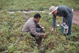
Training Course on Agroforestry Systems: Integrating Trees for Sustainable Land Use and Climate Resilience
Agroforestry Systems Integrating Trees for Sustainable Land Use and Climate Resilience, empowers participants to leverage the synergistic benefits of integrating trees into agricultural landscapes
Agroforestry Systems Integrating Trees for Sustainable Land Use and Climate Resilience, empowers participants to leverage the synergistic benefits of integrating trees into agricultural landscapes

Artificial Intelligence And Block Chain
10 days
Accra, Addis Ababa, Bangkok, Cape Town, Dubai, Istanbul, Kigali, Nairobi, Singapore
Training Course on Artificial Intelligence in Land and Surveying
Training Course on Artificial Intelligence in Land and Surveying delves into the practical applications of AI in land surveying, covering areas such as automated data capture using drones and LiDAR, intelligent processing and analysis of geospatial data, advanced boundary detection and legal compliance, and predictive modeling for land use and environmental impact assessments.
Training Course on Artificial Intelligence in Land and Surveying delves into the practical applications of AI in land surveying, covering areas such as automated data capture using drones and LiDAR, intelligent processing and analysis of geospatial data, advanced boundary detection and legal compliance, and predictive modeling for land use and environmental impact assessments.

Climate Change
5 days
Accra, Addis Ababa, Bangkok, Cape Town, Dubai, Istanbul, Kigali, Nairobi, Singapore
Training Course on Climate Change and Agriculture
Training Course on Climate Change and Agriculture offers farmers, agricultural professionals, and policymakers the tools needed to develop climate-resilient agricultural systems. It highlights the role of technology, innovation, and policy
Training Course on Climate Change and Agriculture offers farmers, agricultural professionals, and policymakers the tools needed to develop climate-resilient agricultural systems. It highlights the role of technology, innovation, and policy
Skills

Climate Change
5 days
Accra, Addis Ababa, Bangkok, Cape Town, Dubai, Istanbul, Kigali, Nairobi, Singapore
Training Course on Climate Change and Water Resources Management
Training Course on Climate Change and Water Resources Management equips participants with the skills and knowledge to understand, evaluate, and respond to the impacts of climate change on water resources.
Training Course on Climate Change and Water Resources Management equips participants with the skills and knowledge to understand, evaluate, and respond to the impacts of climate change on water resources.

Climate Change
5 days
Accra, Addis Ababa, Bangkok, Cape Town, Dubai, Istanbul, Kigali, Nairobi, Singapore
Training Course on Climate Change Vulnerability Analysis
Training Course on Climate Change Vulnerability Analysis equip participants with the necessary knowledge and skills to conduct vulnerability assessments, identify climate risks, and develop adaptive strategies
Training Course on Climate Change Vulnerability Analysis equip participants with the necessary knowledge and skills to conduct vulnerability assessments, identify climate risks, and develop adaptive strategies
5 days
Accra, Addis Ababa, Bangkok, Cape Town, Dubai, Istanbul, Kigali, Nairobi, Singapore
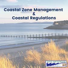
Training Course on Coastal Zone Management
Training Course on Coastal Zone Management delves into the core principles of CZM, emphasizing the importance of ecosystem-based management, coastal resilience building, and the application of spatial planning tools
Training Course on Coastal Zone Management delves into the core principles of CZM, emphasizing the importance of ecosystem-based management, coastal resilience building, and the application of spatial planning tools

5 days
Accra, Addis Ababa, Bangkok, Cape Town, Dubai, Istanbul, Kigali, Nairobi, Singapore
Training Course on Digital Photogrammetric Mapping and Terrain Modelling
Training Course on Digital Photogrammetric Mapping and Terrain Modelling is designed to equip professionals with the skills necessary to use photogrammetric techniques for accurate data
Training Course on Digital Photogrammetric Mapping and Terrain Modelling is designed to equip professionals with the skills necessary to use photogrammetric techniques for accurate data

5 days
Accra, Addis Ababa, Bangkok, Cape Town, Dubai, Istanbul, Kigali, Nairobi, Singapore
Training course on Digital Surveying and Geomatics for Large-Scale Projects
Training Course on Digital Surveying and Geomatics for Large-Scale Projects is meticulously designed to provide participants with the practical application of cutting-edge digital surveying technologies and core geomatics principles
Training Course on Digital Surveying and Geomatics for Large-Scale Projects is meticulously designed to provide participants with the practical application of cutting-edge digital surveying technologies and core geomatics principles
5 days
Accra, Addis Ababa, Bangkok, Cape Town, Dubai, Istanbul, Kigali, Nairobi, Singapore
Training course on Digital Tools for Climate Change Adaptation in Infrastructure
Training Course on Digital Tools for Climate Change Adaptation in Infrastructure is meticulously designed to provide participants with the practical application of cutting-edge digital tools and advanced methodologies
Training Course on Digital Tools for Climate Change Adaptation in Infrastructure is meticulously designed to provide participants with the practical application of cutting-edge digital tools and advanced methodologies
10 days
Accra, Addis Ababa, Bangkok, Cape Town, Dubai, Istanbul, Kigali, Nairobi, Singapore
Training Course on Digital Tools for Water Accounting in Agriculture
Training Course on Digital Tools for Water Accounting in Agriculture is designed to equip agricultural professionals, policymakers, and water resource managers with advanced digital skills for optimizing water usage and sustainability.
Training Course on Digital Tools for Water Accounting in Agriculture is designed to equip agricultural professionals, policymakers, and water resource managers with advanced digital skills for optimizing water usage and sustainability.
Agriculture
5 days
Accra, Addis Ababa, Bangkok, Cape Town, Dubai, Istanbul, Kigali, Nairobi, Singapore
Training Course on Disaster Risk Reduction
Disaster Risk Reduction training course aims to equip participants with the knowledge, skills, and tools required to design, implement, and evaluate effective DRR programs
Disaster Risk Reduction training course aims to equip participants with the knowledge, skills, and tools required to design, implement, and evaluate effective DRR programs
Skills

10 days
Accra, Addis Ababa, Bangkok, Cape Town, Dubai, Istanbul, Kigali, Nairobi, Singapore
Training course on Disaster Risk Reduction (DRR) for Infrastructure Systems
Training Course on Disaster Risk Reduction (DRR) for Infrastructure Systems is meticulously designed to equip civil engineering, urban planning, disaster management, and policy professionals with the advanced knowledge and practical skills
Training Course on Disaster Risk Reduction (DRR) for Infrastructure Systems is meticulously designed to equip civil engineering, urban planning, disaster management, and policy professionals with the advanced knowledge and practical skills

10 days
Accra, Addis Ababa, Bangkok, Cape Town, Dubai, Istanbul, Kigali, Nairobi, Singapore
Training Course on Drone Data Processing and Analysis
Training Course on Drone Data Processing and Analysis equips participants with the fundamental knowledge and practical skills to navigate the entire drone data lifecycle, from understanding data acquisition principles to mastering advanced geospatial analysis techniques.
Training Course on Drone Data Processing and Analysis equips participants with the fundamental knowledge and practical skills to navigate the entire drone data lifecycle, from understanding data acquisition principles to mastering advanced geospatial analysis techniques.
10 days
Accra, Addis Ababa, Bangkok, Cape Town, Dubai, Istanbul, Kigali, Nairobi, Singapore
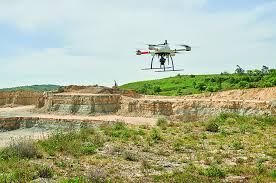
Training Course on Drone Mapping and Surveying
Training Course on Drone Mapping and Surveying provides a comprehensive understanding of how drone technology is revolutionizing the field of data collection, offering real-time, high-resolution images and data for a wide array of applications
Training Course on Drone Mapping and Surveying provides a comprehensive understanding of how drone technology is revolutionizing the field of data collection, offering real-time, high-resolution images and data for a wide array of applications

5 days
Accra, Addis Ababa, Bangkok, Cape Town, Dubai, Istanbul, Kigali, Nairobi, Singapore
Training Course on Drone Photography for Surveying and Mapping
Training Course on Drone Photography for Surveying and Mapping is meticulously designed to equip professionals with the essential skills and knowledge to leverage the power of drone technology for accurate and efficient surveying and mapping.
Training Course on Drone Photography for Surveying and Mapping is meticulously designed to equip professionals with the essential skills and knowledge to leverage the power of drone technology for accurate and efficient surveying and mapping.

10 days
Accra, Addis Ababa, Bangkok, Cape Town, Dubai, Istanbul, Kigali, Nairobi, Singapore
Training Course on Drone Use in Wildlife Monitoring and Conservation
Training Course on Drone Use in Wildlife Monitoring and Conservation is designed to empower conservationists, researchers, and environmental stakeholders with the technical and analytical skills to deploy unmanned aerial vehicles (UAVs) effectively.
Training Course on Drone Use in Wildlife Monitoring and Conservation is designed to empower conservationists, researchers, and environmental stakeholders with the technical and analytical skills to deploy unmanned aerial vehicles (UAVs) effectively.