Spatial analysis Courses
Explore instructor-led and hybrid programs aligned to practical Spatial analysis use cases across industries.
Available Spatial analysis Courses
Showing 1-23 of 23 courses
10 days
Accra, Addis Ababa, Bangkok, Cape Town, Dubai, Istanbul, Kigali, Nairobi, Singapore
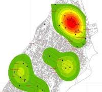
Crime Mapping and Geospatial Analysis (GIS for Criminology) Training Course
Training Course on Crime Mapping & Geospatial Analysis (GIS for Criminology) is a cutting-edge program designed to empower professionals in the criminal justice and public safety sectors with advanced skills in spatial data analysis.
Training Course on Crime Mapping & Geospatial Analysis (GIS for Criminology) is a cutting-edge program designed to empower professionals in the criminal justice and public safety sectors with advanced skills in spatial data analysis.

10 days
Accra, Addis Ababa, Bangkok, Cape Town, Dubai, Istanbul, Kigali, Nairobi, Singapore
Disease Mapping & GIS Training Course
Disease Mapping & GIS Training Course equips learners with advanced skills in spatial data analysis, health informatics, geospatial intelligence, and epidemic surveillance systems.
Disease Mapping & GIS Training Course equips learners with advanced skills in spatial data analysis, health informatics, geospatial intelligence, and epidemic surveillance systems.

10 days
Accra, Addis Ababa, Bangkok, Cape Town, Dubai, Istanbul, Kigali, Nairobi, Singapore
Geospatial Analytics Training Course
Geospatial Analytics Training Course is engineered to bridge the gap between raw geographic data and actionable intelligence by leveraging cutting-edge tools like GIS Remote Sensing, and Spatial Data Science.
Geospatial Analytics Training Course is engineered to bridge the gap between raw geographic data and actionable intelligence by leveraging cutting-edge tools like GIS Remote Sensing, and Spatial Data Science.

5 days
Accra, Addis Ababa, Bangkok, Cape Town, Dubai, Istanbul, Kigali, Nairobi, Singapore
GIS and Spatial Analysis in Political Geography Training Course
GIS and Spatial Analysis in Political Geography Training Course is a dynamic program designed to equip professionals and academics with the advanced skills to apply geospatial technologies to complex political issues.
GIS and Spatial Analysis in Political Geography Training Course is a dynamic program designed to equip professionals and academics with the advanced skills to apply geospatial technologies to complex political issues.

10 days
Accra, Addis Ababa, Bangkok, Cape Town, Dubai, Istanbul, Kigali, Nairobi, Singapore
GIS for Environmental Management Training Course
GIS for Environmental Management Training Course is designed to equip environmental professionals, conservationists, and urban planners with the advanced skills needed to harness the full potential of GIS technology.
GIS for Environmental Management Training Course is designed to equip environmental professionals, conservationists, and urban planners with the advanced skills needed to harness the full potential of GIS technology.

Environmental Management and Conservation
10 days
Accra, Addis Ababa, Bangkok, Cape Town, Dubai, Istanbul, Kigali, Nairobi, Singapore
GIS for Environmental Monitoring and Planning Training Course
GIS for Environmental Monitoring and Planning Training Course focuses on building a strong foundation in geospatial data analysis, remote sensing, and environmental modeling to enable data-driven decision-making.
GIS for Environmental Monitoring and Planning Training Course focuses on building a strong foundation in geospatial data analysis, remote sensing, and environmental modeling to enable data-driven decision-making.

5 days
Accra, Addis Ababa, Bangkok, Cape Town, Dubai, Istanbul, Kigali, Nairobi, Singapore
GIS for Mining Applications Training Course
GIS for Mining Applications Training Course is designed to equip professionals with cutting-edge skills in geospatial technologies tailored specifically for the mining sector.
GIS for Mining Applications Training Course is designed to equip professionals with cutting-edge skills in geospatial technologies tailored specifically for the mining sector.

10 days
Accra, Addis Ababa, Bangkok, Cape Town, Dubai, Istanbul, Kigali, Nairobi, Singapore
Training Course on 3D GIS Modeling and Visualization
Training Course on 3D GIS Modeling and Visualization is meticulously designed to transform your understanding of spatial data from a flat, two-dimensional plane into dynamic, realistic, and highly impactful 3D environments.
Training Course on 3D GIS Modeling and Visualization is meticulously designed to transform your understanding of spatial data from a flat, two-dimensional plane into dynamic, realistic, and highly impactful 3D environments.
5 days
Accra, Addis Ababa, Bangkok, Cape Town, Dubai, Istanbul, Kigali, Nairobi, Singapore
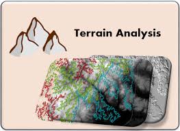
Training Course on Digital Elevation Model (DEM) and Terrain Analysis
Training Course on Digital Elevation Model (DEM) and Terrain Analysis equips professionals with essential skills to leverage geospatial data for informed decision-making across diverse sectors.
Training Course on Digital Elevation Model (DEM) and Terrain Analysis equips professionals with essential skills to leverage geospatial data for informed decision-making across diverse sectors.

5 days
Accra, Addis Ababa, Bangkok, Cape Town, Dubai, Istanbul, Kigali, Nairobi, Singapore
Training Course on Digital Photogrammetric Mapping and Terrain Modelling
Training Course on Digital Photogrammetric Mapping and Terrain Modelling is designed to equip professionals with the skills necessary to use photogrammetric techniques for accurate data
Training Course on Digital Photogrammetric Mapping and Terrain Modelling is designed to equip professionals with the skills necessary to use photogrammetric techniques for accurate data

5 days
Accra, Addis Ababa, Bangkok, Cape Town, Dubai, Istanbul, Kigali, Nairobi, Singapore
Training Course on Geodatabase Analytical Techniques
Training Course on Geodatabase Analytical Techniques empower professionals with the skills to create, manage, and analyze spatial data using advanced geodatabase systems.
Training Course on Geodatabase Analytical Techniques empower professionals with the skills to create, manage, and analyze spatial data using advanced geodatabase systems.
5 days
Accra, Addis Ababa, Bangkok, Cape Town, Dubai, Istanbul, Kigali, Nairobi, Singapore
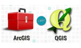
Training Course on Geographic Information System (GIS) in Data and Spatial Analysis
raining Course on GIS Using ArcGIS or QGIS is designed to empower participants with the knowledge and skills to harness GIS for data visualization, spatial analysis, and decision-making
raining Course on GIS Using ArcGIS or QGIS is designed to empower participants with the knowledge and skills to harness GIS for data visualization, spatial analysis, and decision-making

5 days
Accra, Addis Ababa, Bangkok, Cape Town, Dubai, Istanbul, Kigali, Nairobi, Singapore
Training Course on Geoprocessing with R (sf, sp, raster packages)
Training Course on Geoprocessing with R (sf, sp, raster packages) empowers professionals with the advanced skills to analyze, manipulate, and visualize spatial data using the powerful open-source programming language R.
Training Course on Geoprocessing with R (sf, sp, raster packages) empowers professionals with the advanced skills to analyze, manipulate, and visualize spatial data using the powerful open-source programming language R.

10 days
Accra, Addis Ababa, Bangkok, Cape Town, Dubai, Istanbul, Kigali, Nairobi, Singapore
Training course on Geospatial Data Science for Civil Engineering
Training Course on Geospatial Data Science for Civil Engineering is meticulously designed to equip civil engineers and related professionals with the essential theoretical foundations and, critically, the intensive practical skills required to proficiently apply geospatial data science methodologies specifically tailored for complex civil engineering challenges.
Training Course on Geospatial Data Science for Civil Engineering is meticulously designed to equip civil engineers and related professionals with the essential theoretical foundations and, critically, the intensive practical skills required to proficiently apply geospatial data science methodologies specifically tailored for complex civil engineering challenges.

5 days
Accra, Addis Ababa, Bangkok, Cape Town, Dubai, Istanbul, Kigali, Nairobi, Singapore
Training Course on GIS and Remote Sensing for Agricultural Resource Management
Join our expert-led GIS and Remote Sensing for Agricultural Resource Management training course and gain hands-on skills in geospatial analysis, precision farming, and sustainability. Learn how GIS and remote sensing can optimize agricultural productivity, resource allocation, and climate resilience.
Join our expert-led GIS and Remote Sensing for Agricultural Resource Management training course and gain hands-on skills in geospatial analysis, precision farming, and sustainability. Learn how GIS and remote sensing can optimize agricultural productivity, resource allocation, and climate resilience.

10 days
Accra, Addis Ababa, Bangkok, Cape Town, Dubai, Istanbul, Kigali, Nairobi, Singapore
Training Course on GIS and Remote Sensing for Agronomy
Training Course on GIS and Remote Sensing for Agronomy equips agronomy professionals, researchers, and agricultural policymakers with the knowledge and skills to harness the power of GIS and RS for precision farming, crop health monitoring, land evaluation, and sustainable resource management.
Training Course on GIS and Remote Sensing for Agronomy equips agronomy professionals, researchers, and agricultural policymakers with the knowledge and skills to harness the power of GIS and RS for precision farming, crop health monitoring, land evaluation, and sustainable resource management.

10 days
Accra, Addis Ababa, Bangkok, Cape Town, Dubai, Istanbul, Kigali, Nairobi, Singapore
Training course on GIS and Remote Sensing for Renewable Energy
Training Course on GIS and Remote Sensing for Renewable Energy is designed to equip professionals with the skills necessary to leverage these technologies effectively in the renewable energy sector.
Training Course on GIS and Remote Sensing for Renewable Energy is designed to equip professionals with the skills necessary to leverage these technologies effectively in the renewable energy sector.
5 days
Accra, Addis Ababa, Bangkok, Cape Town, Dubai, Istanbul, Kigali, Nairobi, Singapore
Training Course on GIS and Statistical Analysis for WASH Programmes
Training Course on GIS and Statistical Analysis for WASH Programmes equip professionals with the essential skills required to analyze and interpret spatial data and statistical information to improve WASH interventions
Training Course on GIS and Statistical Analysis for WASH Programmes equip professionals with the essential skills required to analyze and interpret spatial data and statistical information to improve WASH interventions

5 days
Accra, Addis Ababa, Bangkok, Cape Town, Dubai, Istanbul, Kigali, Nairobi, Singapore
Training Course on GIS in Disaster Risk Management
Training Course on GIS in Disaster Risk Management course explores how GIS can be integrated into DRM practices, providing hands-on experience with GIS tools and techniques tailored to disaster management scenarios
Training Course on GIS in Disaster Risk Management course explores how GIS can be integrated into DRM practices, providing hands-on experience with GIS tools and techniques tailored to disaster management scenarios

5 days
Accra, Addis Ababa, Bangkok, Cape Town, Dubai, Istanbul, Kigali, Nairobi, Singapore
Training Course on Global Positioning System and Mobile Mapping Technologies
Training Course on GPS and Mobile Mapping for General Applications equips participants with the knowledge and skills to harness these tools for real-world applications
Training Course on GPS and Mobile Mapping for General Applications equips participants with the knowledge and skills to harness these tools for real-world applications

5 days
Accra, Addis Ababa, Bangkok, Cape Town, Dubai, Istanbul, Kigali, Nairobi, Singapore
Training course on Introduction to Digital Cartography and GIS Mapping
Training course on Introduction to Digital Cartography and GIS Mapping offers a comprehensive overview of GIS principles and the technologies involved in the creation of maps and spatial models, ensuring participants develop the skills necessary to manage and interpret geographic data effectively.
Training course on Introduction to Digital Cartography and GIS Mapping offers a comprehensive overview of GIS principles and the technologies involved in the creation of maps and spatial models, ensuring participants develop the skills necessary to manage and interpret geographic data effectively.

10 days
Accra, Addis Ababa, Bangkok, Cape Town, Dubai, Istanbul, Kigali, Nairobi, Singapore
Training Course on Machine Learning for Urban Growth Modeling
Training Course on Machine Learning for Urban Growth Modeling provides a comprehensive exploration of how ML can be applied to urban growth modeling.
Training Course on Machine Learning for Urban Growth Modeling provides a comprehensive exploration of how ML can be applied to urban growth modeling.

10 days
Accra, Addis Ababa, Bangkok, Cape Town, Dubai, Istanbul, Kigali, Nairobi, Singapore
Virtual Reality (VR) and Augmented Reality (AR) for Geographic Information Systems (GIS) Training Course
Virtual Reality (VR) and Augmented Reality (AR) for Geographic Information Systems (GIS) Training Course delves into the fundamental principles and emerging trends of VR and AR integration with GIS, covering everything from 3D modeling and spatial data integration to immersive experience design and application development.
Virtual Reality (VR) and Augmented Reality (AR) for Geographic Information Systems (GIS) Training Course delves into the fundamental principles and emerging trends of VR and AR integration with GIS, covering everything from 3D modeling and spatial data integration to immersive experience design and application development.