Web gis Courses
Explore instructor-led and hybrid programs aligned to practical Web gis use cases across industries.
Available Web gis Courses
Showing 1-6 of 6 courses
5 days
Accra, Addis Ababa, Bangkok, Cape Town, Dubai, Istanbul, Kigali, Nairobi, Singapore
Training Course on Building Custom Widgets and Tools for Web GIS
Training Course on Building Custom Widgets and Tools for Web GIS is designed to equip participants with the essential skills and knowledge to develop custom widgets and powerful geospatial tools for Web GIS applications.
Training Course on Building Custom Widgets and Tools for Web GIS is designed to equip participants with the essential skills and knowledge to develop custom widgets and powerful geospatial tools for Web GIS applications.
10 days
Accra, Addis Ababa, Bangkok, Cape Town, Dubai, Istanbul, Kigali, Nairobi, Singapore
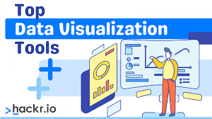
Training Course on Data Visualization Libraries for Web GIS (D3.js, Deck.gl)
Training Course on Data Visualization Libraries for Web GIS (D3.js, Deck.gl) addresses the growing demand for skilled professionals who can bridge the gap between complex geographical information systems and intuitive web-based experiences.
Training Course on Data Visualization Libraries for Web GIS (D3.js, Deck.gl) addresses the growing demand for skilled professionals who can bridge the gap between complex geographical information systems and intuitive web-based experiences.
5 days
Accra, Addis Ababa, Bangkok, Cape Town, Dubai, Istanbul, Kigali, Nairobi, Singapore
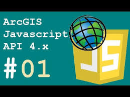
Training Course on Full-stack Web GIS Development with ArcGIS API for JavaScript
Training Course on Full-stack Web GIS Development with ArcGIS API for JavaScript is designed to equip participants with the in-demand skills needed to build robust, interactive, and data-driven geospatial web applications.
Training Course on Full-stack Web GIS Development with ArcGIS API for JavaScript is designed to equip participants with the in-demand skills needed to build robust, interactive, and data-driven geospatial web applications.
10 days
Accra, Addis Ababa, Bangkok, Cape Town, Dubai, Istanbul, Kigali, Nairobi, Singapore
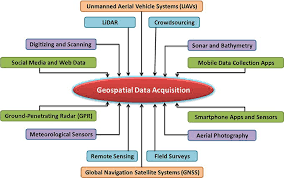
Training Course on Geospatial Data Pipelines for Web Applications
Training Course on Geospatial Data Pipelines for Web Applications will equip participants with the essential skills and knowledge to design, build, and deploy efficient geospatial data pipelines.
Training Course on Geospatial Data Pipelines for Web Applications will equip participants with the essential skills and knowledge to design, build, and deploy efficient geospatial data pipelines.

5 days
Accra, Addis Ababa, Bangkok, Cape Town, Dubai, Istanbul, Kigali, Nairobi, Singapore
Training Course on Open-Source Web GIS Development
Training Course on Open-Source Web GIS Development the growing need for skilled professionals who can harness the power of open-source technologies to create innovative geospatial web applications.
Training Course on Open-Source Web GIS Development the growing need for skilled professionals who can harness the power of open-source technologies to create innovative geospatial web applications.

10 days
Accra, Addis Ababa, Bangkok, Cape Town, Dubai, Istanbul, Kigali, Nairobi, Singapore
User Experience (UX) Design for Geospatial Web Applications Training Course
User Experience (UX) Design for Geospatial Web Applications Training Course delves into the critical role of User Experience (UX) design in creating intuitive, effective, and engaging geospatial web applications.
User Experience (UX) Design for Geospatial Web Applications Training Course delves into the critical role of User Experience (UX) design in creating intuitive, effective, and engaging geospatial web applications.