Master Remote sensing software Training Courses
Advance your Remote sensing software expertise with 1 curated programs covering applied methodologies, analytics, and automation.
1+
Certified Courses
5-10 Days
Duration Range
Why Choose Remote sensing software Training
Build a competitive edge with structured learning paths and real implementation support tailored to Remote sensing software adoption.
Practical Mastery
Develop job-ready Remote sensing software capabilities using real datasets and guided assignments.
Career Outcomes
Align Remote sensing software proficiency with organizational goals and measurable performance improvements.
Remote sensing software Courses
Explore instructor-led and hybrid programs aligned to practical Remote sensing software use cases across industries.
Available Remote sensing software Courses
Showing 1-1 of 1 courses
10 days
Accra, Addis Ababa, Bangkok, Cape Town, Dubai, Istanbul, Kigali, Nairobi, Singapore
Training Course on Advanced Orthorectification and Mosaicking
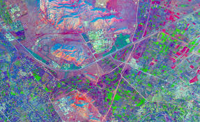
Training Course on Advanced Orthorectification and Mosaicking delves into the critical processes of Advanced Orthorectification and High-Resolution Image Mosaicking, essential for generating precise and seamless geospatial data
Training Course on Advanced Orthorectification and Mosaicking delves into the critical processes of Advanced Orthorectification and High-Resolution Image Mosaicking, essential for generating precise and seamless geospatial data
Explore Related Skills
Expand your learning path with complementary software capabilities.
Ready to upskill in Remote sensing software?
Partner with Datastat Training Institute for immersive Remote sensing software programs delivered by certified practitioners with global project experience.