Conservation Drones Technologies and Ethics Training Course
Conservation Drones Technologies and Ethics Training Course is a comprehensive dive into the intersection of technology and environmental stewardship, focusing on the practical application of drones for wildlife monitoring, habitat mapping, and anti-poaching surveillance
Course Overview
Conservation Drones Technologies and Ethics Training Course
Introduction
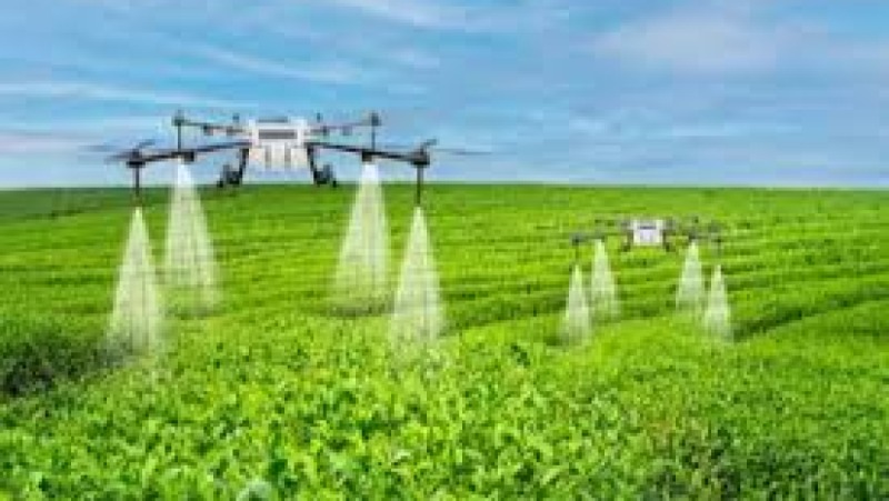
Conservation drones are revolutionizing how we protect our planet, offering unprecedented access and data collection capabilities. Conservation Drones Technologies and Ethics Training Course is a comprehensive dive into the intersection of technology and environmental stewardship, focusing on the practical application of drones for wildlife monitoring, habitat mapping, and anti-poaching surveillance. It goes beyond flight mechanics to address the critical ethical considerations and regulatory frameworks necessary for responsible and impactful drone operations. Through a mix of theoretical knowledge and hands-on practice, participants will gain the skills to implement data-driven conservation strategies, ensuring that their work is not only effective but also socially and ecologically sound.
The field of conservation technology is rapidly expanding, and mastery of Unmanned Aerial Vehicles (UAVs) is becoming a key skill for modern conservationists. This training will equip you with the expertise to navigate this emerging landscape, from understanding advanced sensor technologies like thermal and multispectral imaging to implementing AI-powered analytics for species identification. We emphasize the importance of community engagement and data privacy to build trust with local populations. By the end of this course, you will be prepared to design and execute your own drone-based conservation projects, contributing to a new era of sustainable environmental management and biodiversity protection.
Course Duration
5 days
Course Objectives
- Master drone flight operations and safety protocols for conservation missions.
- Understand the regulatory landscape and legal compliance for UAV use in protected areas.
- Apply real-time wildlife monitoring techniques using high-resolution aerial imaging.
- Utilize thermal and multispectral imaging for population surveys and habitat health assessments.
- Implement anti-poaching surveillance strategies using drones and ground patrol collaboration.
- Integrate drone-captured data with GIS mapping for comprehensive ecosystem analysis.
- Develop AI-powered detection systems for automated species identification and tracking.
- Analyze and interpret data for data-driven conservation strategies and decision-making.
- Identify and mitigate ethical dilemmas related to privacy, data security, and community engagement.
- Design and execute effective habitat mapping and ecosystem restoration projects.
- Explore case studies in marine, forest, and terrestrial conservation using UAVs.
- Assess the environmental impact of drone operations to ensure sustainable technology adoption.
- Develop a capstone project to demonstrate practical skills in conservation project management.
Organizational Benefits
- Drones can cover vast, difficult-to-access areas quickly and cost-effectively, reducing the need for expensive and labor-intensive ground or manned aircraft surveys.
- High-resolution and multispectral sensors provide precise, quantifiable data for population counts, habitat health, and environmental changes, leading to more informed decision-making.
- Drones can be used to survey dangerous or remote locations, minimizing risk to field staff involved in anti-poaching, research, or disaster response.
- Real-time surveillance capabilities help in deterring illegal activities and aid in the rapid deployment of law enforcement or ranger teams.
- Equipping staff with these skills enables participation in global conservation efforts and the adoption of cutting-edge technology to solve complex environmental challenges.
Target Audience
- Wildlife Conservationists and Ecologists
- Environmental Researchers and Scientists
- Protected Area Managers and Park Rangers
- GIS Professionals and Data Analysts in environmental fields
- Non-Governmental Organization (NGO) Staff focused on conservation
- Government Agency Employees in forestry, fisheries, and wildlife departments
- Students and Early Career Professionals in environmental science
- Community Leaders and members of indigenous communities involved in conservation
Course Outline
Module 1: Introduction to Conservation Drone Technology
- History and evolution of UAVs in environmental science.
- Types of drones (fixed-wing, multirotor) and sensor payloads.
- Core drone components, flight dynamics, and maintenance.
- Case Study: The use of fixed-wing drones for large-scale habitat mapping in the Amazon Rainforest.
- Ethical and legal overview of drone use in sensitive areas.
Module 2: Drone Regulations and Flight Safety
- National and international aviation regulations for UAVs.
- Pre-flight checks, mission planning, and risk assessment.
- Emergency procedures and safe landing protocols.
- Case Study: Navigating airspace regulations to monitor marine wildlife in the Great Barrier Reef.
- Best practices for minimizing disturbance to wildlife and local communities.
Module 3: Aerial Imaging and Data Collection
- High-resolution photography and videography for documentation.
- Capturing and transmitting real-time data from remote locations.
- Using automated flight planning for consistent data capture.
- Case Study: WWF's use of drones to count elephant populations in Africa's savanna regions.
- Data storage, management, and security protocols.
Module 4: Advanced Sensing: Thermal and Multispectral Imaging
- Fundamentals of thermal and multispectral sensors.
- Identifying nocturnal species and detecting poaching activity with thermal cameras.
- Assessing vegetation health and drought stress with multispectral data.
- Case Study: Tracking elusive snow leopards in the Himalayas using drones with thermal cameras.
- Calibration and interpretation of sensor data for scientific analysis.
Module 5: Anti-Poaching and Surveillance Strategies
- Designing effective patrol routes and surveillance zones.
- Integrating drone patrols with on-the-ground ranger teams.
- Using live-streaming video for real-time threat detection.
- Case Study: The Kruger National Park's successful implementation of drones to reduce rhino poaching.
- Ethical considerations of surveillance and data privacy.
Module 6: GIS and Data Analysis for Conservation
- Creating orthomosaic maps and 3D models from drone imagery.
- Integrating drone data into Geographic Information Systems (GIS).
- Using AI and machine learning for automated object recognition.
- Case Study: Elephants Without Borders using GIS and drone data to map elephant migration corridors.
- Visualizing data for stakeholder presentations and conservation reports.
Module 7: Ethics, Community Engagement, and Sustainability
- Navigating privacy concerns and legal issues related to surveillance.
- Engaging local communities and obtaining consent for drone operations.
- Developing a code of ethics for conservation drone pilots.
- Case Study: The importance of community collaboration in a drone-based conservation project in Kenya's coastal regions.
- Assessing the environmental footprint of drone technology.
Module 8: Project Design and Implementation
- Developing a conservation project proposal from start to finish.
- Budgeting, resource planning, and team management for a drone mission.
- Simulating real-world conservation scenarios.
- Case Study: A final project where students design a comprehensive plan to monitor endangered sea turtle nesting sites in Costa Rica.
- Final project presentation and peer review for certification.
Training Methodology
This course uses a blended training methodology, combining:
- Expert-Led Lectures.
- Practical Field Exercises.
- Real-World Case Studies.
- Group Projects and Simulations.
- Mentorship and Feedback.
Register as a group from 3 participants for a Discount
Send us an email: info@datastatresearch.org or call +254724527104
Certification
Upon successful completion of this training, participants will be issued with a globally- recognized certificate.
Tailor-Made Course
We also offer tailor-made courses based on your needs.
Key Notes
a. The participant must be conversant with English.
b. Upon completion of training the participant will be issued with an Authorized Training Certificate
c. Course duration is flexible and the contents can be modified to fit any number of days.
d. The course fee includes facilitation training materials, 2 coffee breaks, buffet lunch and A Certificate upon successful completion of Training.
e. One-year post-training support Consultation and Coaching provided after the course.
f. Payment should be done at least a week before commence of the training, to DATASTAT CONSULTANCY LTD account, as indicated in the invoice so as to enable us prepare better for you.